In 1803, the London Missionary Society extended its mission north of the Orange River among a mixed community consisting of members of a Chaguriqua tribe and ‘bastaards’ (of mixed origin) from Piketberg, and local tribes like the Koranna and Tswana.
Their leaders were Adam Kok II and Andries Waterboer. In 1813, at the instigation of Rev John Campbell, the ‘bastaards’ renamed themselves Griqua, and the place called Klaarwater became Griquatown.
Disputes between the two leaders led to the Kok faction leaving Griquatown for Philippolis and Kokstad. When diamonds were discovered the Griqua were one of the parties claiming that the Diamond Fields lay within their territory.
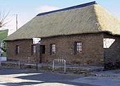
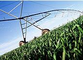
The Keate arbitration awarded the area to Waterboer, who immediately sought Crown protection. This led to the colony of Griqualand West, which was later to be annexed to the Cape Colony. The first council chamber of the Griqua, and the execution tree where Waterboer hanged criminals, can be seen in Water Street. Griquatown is known for its semiprecious stones, tiger’s eye and jasper. The town is a centre for stockbreeding.