Home --> Destinations --> Green Kalahari --> Kakamas 

Kakamas 

 Location: 80km southwest of Upington on the N14.

Nearby towns: Pofadder, Kenhardt, Keimoes, Kanoneiland, Upington 

 To some, the town’s name originates from the Khoi word, ‘gagamas’ (brown), referring to the red clay of the area with which women daub their faces. To most, though, Kakamas is a Koranna word meaning ‘poor pasture’ and ‘vicious, charging ox’. 


Legend has it that grazing in the vicinity was poor and, when cattle were driven through the river’s drifts, some turned on their drivers. Today, the name reflects poorly on a fertile valley in the Lower Orange River, graced with vineyards, cotton and lucerne fields. 

The drought of 1895-97 was followed by an outbreak of rinderpest, leaving many farmers destitute. Knysna’s Dutch Reformed Church minister, BPJ Marchand, sometimes called the father of Kakamas, played a leading role in saving people from ruin. The river islands of Marchand, Zoetap and Neus became a labour colony for the poor. 

So successful were their farming ventures that full title to the land was granted them. In 1930, the church divided an area in central Kakamas into 40 residential plots.This was the beginning of Kakamas township. Cultivating grapes for raisins began in 1960 and table grapes in 1980. Today, they are exported worldwide.

Map Kakamas: 

Accommodation Kakamas 

Explore Kakamas 

Egyptian-styled Hydroelectric Power Station.

to be seen in the main road.

German War Gravves

The graves of German soldiers killed in a 1915 clash with South African troops lie at the foot of a low hill just outside town, on the N14 to Kakamas.
Irrigation Tunnels

Built by Cornish miners, they can be seen outside Kakamas, on the N14.
Kalahari Adventure Centre

Rafting, canoeing, hiking, desert adventures and Kalahari backroads safaris. 

Contact Northern Cape Travel for more information.

Khamkirri Private Game Reserve

"Place of the Leopard", the name given by the name for this part of the world. This Private Game Reserve, consisting of 7 500ha, is situated where the mighty Orange River and the Kalahari meet.
Game drives, river rafting, 4x4 routes, 4x2 bakkie routes, horse riding, angling, abseiling, waterskiing and hiking trails.
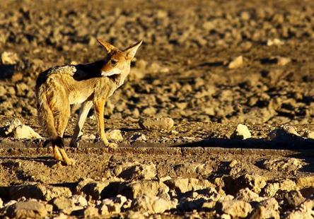
Contact Northern Cape Travel for more information. 
Operating Waterwheels

Eleven waterwheels are still used on the canals. They can be seen in Voortrekker Street or on the many canals running through the vineyards, lucerne and cottonfields.
Riemvasmaak Hot Springs

North of the mighty Augrabies Falls, between the Orange and dry Molopo Rivers, lies 75 000 hectares of sheer mountain desert wilderness born of violent volcanic activity millions of years ago. You will be dwarfed by eighty metre high granite cliff walls and awesome lunar landscape-like scenery. 
It is inhabited by friendly Riemvasmaak people.

Indulge in a great 4x4 experience.

Contact Northern Cape Travel for more information. 
 The Rockery Route

Following the gravel road from Neilersdrift to Kakamas via the Neus Wier, you will be stunned by differing landscapes. At times, the world is transformed into a series of rocky outcrops with twisted kokerbome and camelthorn trees - at others, the lush vineyards on the river's many islands cover the landscape in grass-green splendour.

Wine Tasting and Tours
Offered at the Orange River Wine Cellars Co-operative.

Contact Northern Cape Travel for more information.