Named after Hans Brits, who accompanied David Livingstone on a venture to the interior and then settled on the farm, Gemsbokfontein. In 1877, an association of local men, headed by TP Theron, bought a section of the farm on which they built a community centre and a church.
A private irrigation scheme was started by the Smartt Syndicate in 1885 and liquidated in 1954. The concern built two dams, planted lucerne and wheat and grazed karakul sheep and Clydesdale horses. The 1961 floods destroyed the Smartt Irrigation Board Dam, rebuilt by the government in 1964.
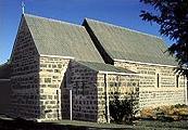
Britstown Museum Raath Street. Originally the Holy Trinity Church.
Dutch Reformed Church Church Str. Built in 1877.
Hiking Experience the unique Karoo landscape on several hiking trails on surrounding farms. Arrangements by Transkaroo Country Lodge.
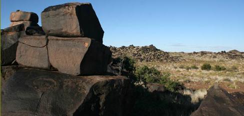
Khoisan Rock Art Interesting archeological sites on farms Brakwater, Keurfontein, Maritzdam and Omdraaivlei are considered important heritage sites. Permission required to visit.
Stargazing Excursions to marvel at the sparkling Karoo night sky can be arranged by Transkaroo Country Lodge.